293 Environmental Mapping Processor
293 : Environmental Mapping Processor
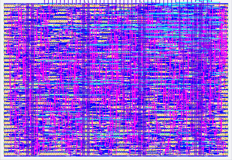
- Author: Gina Ferguson
- Description: A SKY130 environmental sensor processing ASIC for temperature, humidity, and pressure measurements.
- GitHub repository
- Open in 3D viewer
- Open in Tiny Tapeout Explorer
- Clock: 10000000 Hz
Environmental + Spatial Edge Processor
How it works
The Environmental + Spatial Edge Processor is a small digital ASIC designed for low-power environmental monitoring and location-aware field data collection.
<img width="1536" height="1024" alt="Tricorder" src="https://github.com/user-attachments/assets/115af43a-db4c-475f-84a1-699c713daaa4" />
The design combines two hardware-processing functions:
- Environmental processing for temperature, humidity, and atmospheric pressure.
- Spatial processing for determining whether a device is within a configurable distance of a target location.
The ASIC is intended to operate as part of a portable environmental mapping device. External sensors and a GNSS receiver provide measurements and position information through a small low-power controller, while the ASIC performs the environmental and spatial edge-processing operations.
Environmental processing
The ASIC supports three independent environmental measurement channels:
- Temperature
- Relative humidity
- Atmospheric pressure
An external environmental sensor, such as a BME280, provides digitized measurements to a small external controller. The controller converts the measurements into the unsigned 8-bit representation expected by the ASIC.
<img width="382" height="606" alt="Screenshot 2026-08-21 at 2 32 38 PM" src="https://github.com/user-attachments/assets/b4b6c5e3-8ae8-4173-8495-e13103d5c842" /> <img width="431" height="441" alt="Screenshot 2026-08-21 at 4 21 56 PM" src="https://github.com/user-attachments/assets/992cb916-2199-4820-addc-33574a0d1ac5" />
- Latest measurement
- Minimum measurement
- Maximum measurement
- Eight-sample average
- Programmable low threshold
- Programmable high threshold
- High/low anomaly detection
ui_in[1:0] |
Data type |
|---|---|
00 |
Temperature |
01 |
Humidity |
10 |
Pressure |
11 |
Spatial data |
When ui_in[2] (sample_valid) is asserted, the ASIC captures the value on uio_in[7:0].
Each environmental channel independently maintains:
- Latest measurement
- Eight-sample average
- Programmable low threshold
- Programmable high threshold
- Low/high anomaly detection
The eight-sample average is calculated using an accumulator. Eight consecutive measurements of the same environmental type are summed and divided by eight using a three-bit right shift.
This avoids the area cost of implementing a general-purpose hardware divider.
Reading environmental results
ui_in[3] selects the environmental result:
ui_in[3] |
Result |
|---|---|
0 |
Latest measurement |
1 |
Eight-sample average |
ui_in[4] is unused.
The selected 8-bit result is presented on uo_out[7:0].
ui_in[5] clears the accumulated averaging state.
Minimum and maximum measurements
Lifetime minimum and maximum measurements are intentionally not stored inside the ASIC.
In the complete portable system, the external low-power controller can maintain min/max values in its own memory and optionally store long-term observations on a microSD card.
Moving this historical bookkeeping outside the ASIC reduces silicon utilization while preserving the more specialized environmental and spatial processing in hardware.
Programmable environmental thresholds
Each environmental channel contains programmable low and high thresholds.
The operating mode is selected using ui_in[7:6]:
ui_in[7:6] |
Operation |
|---|---|
00 |
Submit normal sample/current position |
01 |
Program low threshold/spatial target |
10 |
Program high threshold/spatial radius |
11 |
Read combined status |
For example, a temperature channel could be configured with:
LOW  = 50
HIGH = 100
A temperature measurement of 75 produces no anomaly.
A measurement of 110 produces a high-temperature anomaly.
A measurement of 40 produces a low-temperature anomaly.
The ASIC performs these comparisons directly in hardware.
Spatial processing
The ASIC also contains a compact spatial-processing engine.
It operates on an 8 × 8 local coordinate grid using 3-bit X and Y coordinates:
X = 0–7
Y = 0–7
The external controller is responsible for obtaining real-world position information, such as GNSS latitude and longitude, and translating that position into the local coordinate representation used by the ASIC.
The ASIC itself then performs the spatial calculations.
It stores:
- Current X coordinate
- Current Y coordinate
- Target X coordinate
- Target Y coordinate
- Target radius
Manhattan distance engine
The ASIC calculates Manhattan distance between the current position and the configured target:
distance =
    |current_x - target_x|
    +
    |current_y - target_y|
For example:
Target  = (3, 4)
Current = (4, 5)
The ASIC calculates:
|4 - 3| + |5 - 4|
    = 1 + 1
    = 2
The calculated distance can be read from the ASIC output when the spatial channel is selected.
Spatial radius / zone detection
A programmable radius defines a target zone.
The ASIC evaluates:
inside_target_zone =
    distance <= target_radius
For example:
Target  = (3, 4)
Radius  = 3
Current = (4, 5)
produces:
Distance = 2
2 <= 3
Therefore:
inside_target_zone = 1
If the device moves to:
Current = (7, 7)
the ASIC calculates:
|7 - 3| + |7 - 4|
    = 4 + 3
    = 7
Since:
7 > 3
the device is outside the configured target zone.
Spatial zone detection does not become active until a valid current location has been supplied.
Location-aware environmental events
The environmental and spatial engines can operate together.
The ASIC generates a location-aware environmental event when:
environmental anomaly
        AND
inside target spatial zone
are both true.
This allows the hardware to answer questions such as:
Is an abnormal environmental condition occurring within the geographic area I am monitoring?
For example:
Target location = (3, 3)
Radius          = 2
Current         = (4, 3)
Temperature     = 120
High threshold  = 100
The spatial engine determines that the current location is inside the target zone.
The environmental engine determines that the temperature exceeds its programmed threshold.
The ASIC therefore asserts the combined location-aware environmental event.
If the device moves outside the target zone, the environmental anomaly may remain active while the combined location-aware event becomes inactive.
Status output
When ui_in[7:6] = 11, uo_out[7:0] provides the combined status byte:
| Bit | Meaning |
|---|---|
| 7 | Location-aware environmental event |
| 6 | Any environmental anomaly |
| 5 | Inside target spatial zone |
| 4 | Temperature high |
| 3 | Temperature low |
| 2 | Humidity high |
| 1 | Humidity low |
| 0 | Pressure anomaly |
This provides a compact hardware status interface for an external controller or display system.
How to test
Set ena high and reset the ASIC by driving rst_n low for at least two clock cycles, then drive rst_n high.
Submit an environmental measurement
- Select the environmental channel with
ui_in[1:0]. - Place the unsigned 8-bit measurement on
uio_in[7:0]. - Set
ui_in[7:6] = 00. - Assert
ui_in[2](sample_valid). - Allow a rising edge of
clk. - Deassert
sample_valid.
For example, submitting these eight temperature samples:
64, 66, 68, 70, 72, 74, 76, 78
produces:
Latest  = 78
Average = 71
Temperature, humidity, and pressure averaging state is maintained independently.
Configure a spatial target
Select the spatial channel:
ui_in[1:0] = 11
Set:
ui_in[7:6] = 01
Place the target coordinates on:
uio_in[5:3] = target X
uio_in[2:0] = target Y
Assert sample_valid for one clock cycle.
Configure the target radius
Select:
ui_in[1:0] = 11
ui_in[7:6] = 10
Place the radius on:
uio_in[3:0]
Assert sample_valid for one clock cycle.
Submit the current position
Select:
ui_in[1:0] = 11
ui_in[7:6] = 00
Place the current coordinates on:
uio_in[5:3] = current X
uio_in[2:0] = current Y
Assert sample_valid for one clock cycle.
The ASIC then calculates the Manhattan distance and determines whether the current location is inside the configured target radius.
Cocotb verification
The Cocotb test suite verifies:
- Latest temperature, humidity, and pressure values
- Eight-sample averaging
- Independent environmental channels
- Clearing accumulated averaging state
- Programmable environmental thresholds
- Environmental anomaly detection
- Spatial target programming
- Spatial radius programming
- Current-position updates
- Manhattan distance calculation
- Inside/outside target-zone detection
- Combined location-aware environmental events
The RTL tests can be run using:
cd test
make
GitHub Actions additionally runs the Tiny Tapeout automated test, documentation, synthesis, physical-design, and precheck workflows.
External hardware
The ASIC performs digital processing and does not directly contain environmental sensors, GNSS reception, a display, or long-term storage.
A future portable implementation is intended to combine the ASIC with:
- Low-power GNSS receiver with integrated antenna
- BME280 temperature/humidity/pressure sensor
- Low-power microcontroller
- Small Memory LCD
- microSD storage
- Rechargeable LiPo battery
- Low-power voltage regulation and charging circuitry
- Wake/power button
The BME280 is not a permanent requirement. Other digital environmental sensors could be used as long as the external controller translates their measurements into the input representation expected by the ASIC.
The controller would handle:
- GNSS communication
- Environmental sensor communication
- Conversion of GNSS coordinates into the ASIC's local X/Y grid
- Lifetime minimum/maximum tracking
- Display control
- microSD logging
- Power-management coordination
The ASIC remains responsible for the dedicated edge-processing operations:
- Environmental averaging
- Threshold comparisons
- Environmental anomaly detection
- Manhattan spatial distance
- Target-zone detection
- Combined location-aware environmental event detection
This architecture allows the environmental and spatial calculations to remain implemented as dedicated digital hardware while leaving communication, storage, display, and long-term historical data management to the external low-power controller.
-- #Other Parts Needed: <img width="1203" height="581" alt="Screenshot 2026-08-21 at 3 50 59 PM" src="https://github.com/user-attachments/assets/56e370c9-2b0a-488f-895b-e05cb9a032b9" />
IO
| # | Input | Output | Bidirectional |
|---|---|---|---|
| 0 | sensor_type[0] | result[0] | sensor_data[0] |
| 1 | sensor_type[1] | result[1] | sensor_data[1] |
| 2 | sample_valid | result[2] | sensor_data[2] |
| 3 | output_select[0] | result[3] | sensor_data[3] |
| 4 | output_select[1] | result[4] | sensor_data[4] |
| 5 | clear_stats | result[5] | sensor_data[5] |
| 6 | mode[0] | result[6] | sensor_data[6] |
| 7 | mode[1] | result[7] | sensor_data[7] |